
Draft Basin Plan release
The Draft Basin Plan was released on the 28th November. The Plan is being developed to address the need to maintain the Murray–Darling Basin as a healthy, working river system. A key feature of the proposed Basin Plan is setting a long-term environmentally sustainable level of take (ESLT) of water from its rivers of 10,873 GL/y. The aim of the ESLT is to ensure that there is enough water left in the river system to meet environmental needs.
Hydrologic modelling undertaken by the MDBA indicates existing water recovery will provide the environmental water requirements of the Lachlan indicator sites (Booligal Wetlands, Cumbung and Lachlan swamps) and no further reduction is required. This assessment will be reviewed following the 20 week consultation period. Further information can be found at: http://www.mdba.gov.au/draft-basin-plan
WETLAND WATERING
Muggabah Watering
A total of 5,275 ML was delivered to Muggabah Creek in the lower Lachlan Catchment between 14 August and 10 October 2011. This delivery added to environmental watering activities in the Merrimajeel system, which began in early June 2011.
The generally dry conditions experienced during September and the less than usual proportion of flows travelling down Torriganny Creek resulted in reduced flow rates into parts of the system. These conditions reduced volume and duration of flows to the lignum channels in the lower Muggabah on Little Lake.
These conditions also hindered the planned delivery of water to Lower Gum Swamp. However, local reports and analysis of Landsat imagery for the period indicated that the levels achieved in the upper section of the Creek over the last few weeks of the environmental water delivery (approximately 95ML/day) approached the commence to flow levels for the Swamp. It is possible this occurred due to increased vegetation growth in the channel raising water levels in the upper reaches of the creek.
Outcomes from this watering action included:
Muggabah Creek near Cobb Highway (3/11/11)
- a good growth response from aquatic plants such as nardoo, water primrose and rushes in
Muggabah Creek upstream from Greenvale. - a vigorous growth response from lignum, most notably, upstream of Boxyards Road and in areas closer to the braided channels downstream of Boxyards Road.
- connection of flows in the Muggabah and Merrimajeel creeks across the braided channels of the Booligal wetland system.
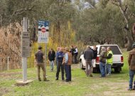
During the Muggabah and Merrimajeel watering events, regular communication occurred with key members of the Torriganny, Merrimajeel and Muggabah Creeks District Trust, members of the LRWG, Hay Area office of NPWS and State Water. This communication and the cooperation received from all greatly assisted the water deliveries.
Merrowie Watering
Lower end of Box Creek beginning to dry down (3/11/11)
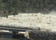
The watering action, using Commonwealth and State environmental water commenced on 14 June 2011 and ceased 24 October 2011. A total volume of 18,702 ML was delivered.
Ecological objectives achieved from the watering action included:
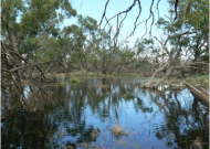
- re-filling and prolonged inundation of Lake Tarwong.
- increased system connectivity through the inundation of the full length of Merrowie Creek, as well as inundation of Box Creek to its confluence with Merrimajeel Creek.
- improved condition of lignum in the inundated areas along Merrowie Creek upstream of Cuba Dam. Lignum close to the main channels of the creek below Cuba Dam also responded well. Lignum around Lake Tarwong also exhibited new growth and flowering.
- prolonged inundation of Murphy’s Lake and support of a successful conclusion of sea eagle, cormorant and darter breeding.
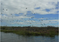
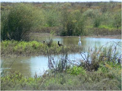
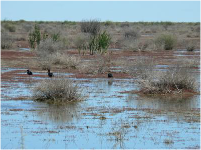
Glossy ibis and egrets at Merrowie Creek (3/11/11)

Though there were lower than anticipated flow rates into Murphy’s Lake, the sea eagle young have fledged and cormorant and darter young have also left the nest and are flying. During this watering event, regular communication occurred with key members of the Merrowie Creek District Trust, landholders below Cuba Dam, members of the LRWG, Hay Area office of NPWS and State Water. This communication and the cooperation received from all greatly assisted the water delivery.
Photo: Glossy ibis and egrets at Merrowie Creek (3/11/11)
Murrumbidgil Swamp/Lake Merrimajeel Watering

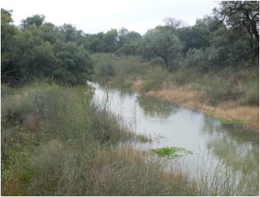
Merrimajeel Ck upstream of Alma Road bridge (1/9/11)
A total volume of 7,070 ML was delivered into Merrimajeel Creek with flows commencing on 21/6/11 and ceasing on 13/9/11. However, flows continued towards Murrumbidgil Swamp, providing support of ecological responses. Though flow in the Merrimajeel Creek generally remained within the channel, levels in Murrumbidgil Swamp rose to the point where a small volume of water (approximately 10 ML) flowed into Lake Merrimajeel.
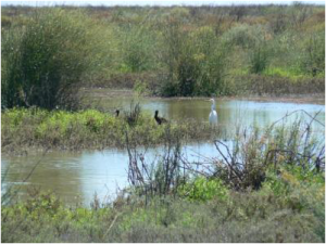
Glossy ibis, dotterels and stilts foraging at Lake Merrimajeel (3/11/11)
Initially flows travelled down Merrimajeel Creek more rapidly than in the previous watering events, however there was not enough volume behind the front of the flow to push a large amount of water into Lake Merrimajeel. Despite this, a good vegetative response has been observed in Murrumbidgil Swamp with some river red gums flowering, significant epicormic shooting and vigorous new foliage appearing. New shoots were also observed on the formerly skeletal lignum in the Swamp and lignum along the Merrimajeel Creek channel, upstream of the swamp, has vigorously responded. Murrumbidgil Swamp is now rapidly drying down as the vegetation response to the wetting accelerates.
Lake Merrimajeel supported a resident population of glossy Ibis overthe late winter and spring, with between 200-500 individuals foraging on the shallow shoreline and lake bed. Other birds observed at the Lake over spring have included pelicans, magpie geese, royal spoonbills, yellow spoonbills, egrets, white-necked herons, black-winged stilts, red-kneed dotterels, shelducks, black swans, coots, swamphens, moorhens and swamp harriers.
Summary of environmental water deliveries to from June to December 2011
Watering targets
Duration of water delivery
Volume delivered (MegaLitres)
C = Commonwealth
S = State
Muggaba
14 Aug – 10 Oct 2011
5,275 ML
C: 3,861 ML
S: 1,414 ML
Merrimajeel Creek
Murrumbidgil Swamp
Lake Merrimajeel
21 Jun – 13 Sep 2011
7,070 ML
C: 5,175 ML
S: 1,895 ML
Merrowie Creek
Lake Tarwong
14 Jun – 24 Oct 2011
18,702 ML
C: 13,690 ML
S: 5,012 ML
Table 1 Summary of environmental water deliveries from June to December 2011
|
Duration of water delivery |
Volume delivered* |
Watering targets |
|
14 June to 24 October 2011 |
18,702 ML(C’wealth = 13,690 ML; State = 5,012 ML) | Merrowie Creek – Lake Tarwong |
|
21 June to 13 September 2011 |
7,070 ML (C’wealth = 5,175 ML; State = 1,895ML) |
Merrimajeel Creek; Murrumbidgil Swamp; Lake Merrimajeel |
| 14 August 10 October 2011 | 5,275 ML(C’wealth = 3,861 ML; State = 1,414 ML) |
Muggabah Creek |
Future Environmental Watering – For the remainder of the 2011/12 (January to June 2012)
Water allocations available against the Commonwealth’s entitlement exceeds 60,000 ML, while the allocation available to NSW OEH is around 19,000 ML. Environmental water delivery plans for the remainder of the 2011- 2012 water year include a contingency to deliver up 10,000 ML (7,320 ML Commonwealth) for the successful completion of waterbird breeding, should a colonial breeding event occur, and possible deliveries to wetlands including the Lower Lachlan and Cumbung swamps. Proposals for the use of Commonwealth environmental water are assessed against criteria including ecological significance, expected ecological outcomes, the potential risks of the proposed watering action, long-term sustainability and cost effectiveness and operational feasibility of undertaking the watering. More details can be found on the Commonwealth Environmental Water website.
In accordance with the Lachlan Environmental Water Management Plan and the NSW OEH Annual Environmental Water Plan any decision made regarding delivery of environmental water will take into account the time since last watering, volumes available for watering, (i.e. is there sufficient water available to achieve the environmental objectives), efficiency of delivery ( i.e. whether the water can reach the target), and the environmental need, (i.e. bird breeding completion or averting fish kills may take precedence over other environmental needs).
PROJECT UPDATE
Instream refugia in the Lachlan River during a no flow period – A study by Darice Pepper, Forugh Dorani and Lorraine Hardwick – NSW Office of Water
Officers from the NSW Office of Water investigated aquatic habitat responses in the Lachlan River downstream of Condobolin during the cease to flow period over the 2009/10 summer. A summary of their findings are presented below.
The Lachlan River below Condobolin ceased flowing due to the limited water available in Wyangala Dam
attributable to the drought. The impacts of such an event were unclear, but it was expected that the aquatic habitats in the river would become disconnected and the instream habitats would become increasingly hostile to many aquatic organisms as a result of increasing thermal and chemical stratification in the remaining aquatic instream habitats.
This project investigated the impacts of low flow and cease to flow periods on the instream aquatic habitat. Initial remote sensing mapped remaining instream refugia. Temperature stratification of five key aquatic refugia sites was investigated in Booberoi, Lake Cargelligo, Willandra, Hillston and Booligal Weir pools (see map below) using a series of thermistor chains. Weekly dissolved oxygen profiles were also taken. Nutrients and algae were also assessed.
Results suggested that, over summer, conditions within the remaining pools deteriorated dramatically with high surface temperatures and very low oxygen levels. These in-stream water quality conditions severely limit the available habitat for fish. The low oxygen bottom waters can not support fish and the surface water provide sub-optimal habitat due to high water temperatures and increased likelihood of predation. A rainfall event occurred before conditions deteriorated to the extent that may have resulted in fish kills.
During these low flow periods consideration of the protection of low flow refugia will need to consider both low oxygen levels and poor habitat for fish and the development of blue green algal blooms. Further analysis will be undertaken to investigate drought refuge dynamics and to develop flow models for prevention and mitigation of blue-green blooms.