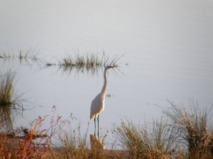
Wetlands are among the most productive and biologically diverse ecosystems throughout the world and provide essential habitats for invertebrates, plants, fish and birds (CRCFE 1995). Wetlands also increase the productivity of associated aquatic and terrestrial ecosystems, provided connectivity with these systems is maintained.
The benefits of healthy wetlands include:
- flood mitigation through the provision of hydrological buffers within catchments by spreading flood peaks, storing floodwaters and releasing them gradually (Brinson et al. 1996);
- drought refuge for wildlife and grazing for stock (NSWWRC 1993; Sharley & Huggan 1994);
- groundwater replenishment (Brinson et al. 1996);
- improving water quality by absorbing, recycling and releasing nutrients and trapping sediment (Howard-Williams 1985, Maltby 1991);
- providing breeding sites for native fish, birds, plants and invertebrates (Maher 1984, Briggs and Maher 1985, Kingsford et al. 1996);
- recreation and tourism potential; and
- enhanced scenic and aesthetic values.
Semi-permanent wetland vegetation types, particularly in the mid to lower Lachlan, require regular, frequent and prolonged flooding. Some have specific legislative protection, and some plants, such as River Red Gum, River Cooba, Cumbungi and Nardoo have iconic Aboriginal cultural values. Wetland types which exist throughout the Lachlan are discussed briefly below.
River Red Gum Forest and Woodland
River Red Gum (Eucalyptus camaldulensis) is widespread in Australia and occurs most commonly in narrow bands fringing watercourses. In the Lachlan, it forms extensive floodplain forests and woodlands and is a distinctive and important part of the floodplain character. The community is described as vulnerable, with approximately only 50% of its pre-European extent remaining in western NSW (Benson 2006). It provides waterbird nesting sites and habitat for many animals including woodland birds.
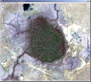
Satellite imagery of River Red Gum forest located in Murrumbidgil Swamp, lower Lachlan Catchment (Image: Lisa Thurtell and Paul Packard, OEH)
By 2010, a large percentage of River Red Gums previously identified as stressed in the lower Lachlan had died. A study on the effect of river regulation on River Red Gums on the Booligal Wetlands indicated that there had also been a significant decline in River Red Gum populations in that area as a result of river regulation. The nature of some areas of woodland and forest is changing, with an increase in the area of understorey species suited to drier conditions, such as dryland grasses and chenopods. One indicator of changing flow regime in parts of the lower Lachlan is the colonisation of some areas of River Red Gum woodland by dryland species, including saltbush. General water requirements of River Red Gum forest and woodland includes inundation in winter, spring or summer every one to two years, lasting a minimum of between four and seven months, but no longer than 24 months. Complete soil drying between flood cycles is important (Roberts and Marston 2000).
Common Reed Grassland
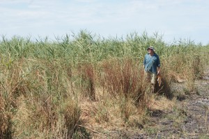
Extensive stands of Common Reed (Phragmites australis ‘reedbeds’) are a distinctive part of the character of the Great Cumbung Swamp, which provides a wide range of habitats and is a major drought refuge. The area of common reed in the Cumbung is approximately 4000 ha. Common reed tolerates a range of flood frequencies from permanent inundation to infrequent flooding. To maintain vigour flooding is required at least every one in five years (Roberts and Marston 2000).
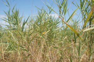
Close-up photograph of Common Reed (Phragmites australis), Reed Bed, Great Cumbung Swamp (Image: Joanne Lenehan, LLS, 19 February 2013)
Germination and seedling requirements for Common Reed are largely unknown but seed germination is better in moist rather than waterlogged conditions. Vegetative regeneration from stem and rhizome fragments may be important. If large stands are lost they could be difficult to restore and this maybe a critical factor for the Cumbung, as Common Reed is important habitat for many waterbirds and provides nest platforms for large breeding colonies of ibis.
Water Couch Grassland
Water Couch (Paspalum distichum) marsh is an important wetland community in the lower Lachlan. Water Couch needs wet or moist soil conditions for 75% of the year, although it can tolerate dry periods of up to three years (Roberts and Marston 2000). Flooding can be continuous for four to six months, or more, or can come in two or three separate events. Water Couch can recover from a one to three year dry spell, but cannot tolerate extended or frequently repeated dry periods, however spring and summer flooding is important. During the drought, most areas of water couch in the Lachlan were not receiving the flows they needed, and some areas did not received any flows at all from 2000 to 2010. Water Couch is a prolific seeder but there is some evidence that it regenerates more successfully from fragments or buried nodes. If this is the case, the loss of water couch from large areas may mean it cannot quickly recover, as its regeneration is dependent on the presence of mature, healthy plants with trailing stems. It does not tolerate grazing well when water stressed or persistent grazing when under water. However, recent research suggests that under suitable flow conditions, grazing is a factor in maintaining the dominance of water couch in grassy wetland communities (Wilson et al. 2008).
Lignum Shrubland
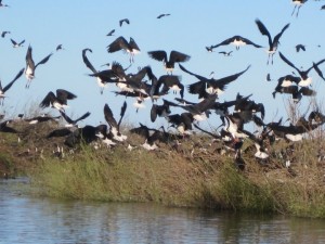
Lignum (Muehlenbeckia florulenta) requires an average flood frequency of one in three to seven years with average duration of three to 12 months (Davis et al 2001). Optimal flood timing for growth and recruitment is probably spring and summer. Surface soil drying between flood cycles is important to maintain healthy Lignum. The water requirements to regenerate Lignum are not well known but field observations suggest summer flooding with inundation lasting for several months is required to allow seedling establishment (Roberts and Marston 2000). Lignum occurs throughout the mid to lower Lachlan as an understorey plant but forms shrublands in many areas. It provides valuable waterbird breeding habitat especially for ibis and is listed as a vulnerable community in NSW. The photo to the right shows ibis, in Merrimajeel Creek, utilising Lignum for breeding purposes.
Black Box Woodlands
Black Box (Eucalyptus largiflorens) woodland is considered by Benson (2006) to be a vulnerable plant community in NSW. There has been decline in its distribution due mostly to clearing for agriculture. Black Box woodland is found on flat to slightly undulating landscapes on alluvial soils within rainfall ranges of between 250 to 450 mm a year. In most areas, Black Box woodland is bordered by River Red Gum or grassland ecosystems. It is characterised by a dense to sparse canopy, usually 15–20 m tall, over a understory of small to medium-sized saltbushes, and short-lived herbs and grasses, with occasional patches of Lignum. Black Box requires summer flooding for regeneration. Black Box occurs most commonly in the ephemeral wetland vegetation zone in the Lachlan, including the Lachlan and the Great Cumbung swamps.
River Cooba Scrub
Little is known about the ecology of River Cooba (Acacia stenophylla). In the Lachlan, it is mostly found in the lower catchment and is often associated with River Red Gum or Lignum. It provides valuable nesting habitat, especially for colonially-nesting species (Kingsford and Johnson 1998; Kingsford and Auld 2005).
Coolibah Woodland
Coolibah–Black Box woodland is listed as an endangered ecological community under the NSW Threatened Species Conservation Act 1995 and Coolibah (Eucalyptus microtheca or Eucalyptus coolabah) open woodland is considered by Benson (2006) to be an endangered plant community in NSW. Coolibah occurs in some wetter parts of marsh areas in association with River Red Gum, although more commonly in less frequently flooded sites, between River Red Gum and Black Box woodlands. Coolibah requires flooding for regeneration. Although its broad ecological requirements are not well known, it has shown that Coolibahs will die if inundated for too long (Roberts and Marston 2000). It is recommended that inundation of Coolibah woodland last no longer than six to eight months. Coolibah appears to need less flooding than River Red Gum but more than Black Box. This contrasts with the generally accepted view of its water requirements, which suggest that Black Box requires wetter conditions than Coolibah. As the majority of Coolibah in the Lachlan occurs in the ephemeral vegetation zone, it currently can only be inundated in large floods. Insufficient flooding, a lack of information about its ecological requirements and clearing are all significant management issues for Coolibah woodland.
Myall Woodland
This ecological community is scattered across the eastern parts of the alluvial plains of the Murray-Darling river system. Typically, it occurs on red-brown earths and heavy textured grey and brown alluvial soils within a climatic belt receiving between 375 and 500 mm mean annual rainfall. Myall or Weeping Myall (Acacia pendula) woodland is listed as an endangered ecological community under the NSW Threatened Species Conservation Act 1995, and Weeping Myall open woodland is considered by Benson (2006) to be an endangered plant community with only 14% of its original area remaining in NSW. Despite its endangered status, little is known of the ecological requirements of Weeping Myall.
The structure of the community varies from low woodland to or open shrubland, depending on site quality and disturbance history. The tree layer grows up to a height of about 10 m, and the understorey includes an open layer of chenopod shrubs and other woody plant species, and an open to continuous groundcover of grasses and herbs. The structure and composition of the community varies, particularly with latitude, as saltbush is more prominent in the western areas of the Lachlan Catchment, while other woody species and summer grasses are more common further east. In some areas the shrub stratum may have been reduced or eliminated by clearing or heavy grazing. It occurs most commonly in the ephemeral vegetation zone in the Lachlan, usually on the outer floodplain and is inundated only in large floods. It is not known whether it requires flooding for maintenance or regeneration.
Gilgai Depressions
Gilgai depressions are found throughout the mid-Lachlan floodplain and often support Weeping Myall, Belah (Casuarina cristate), Black Box, Bimble Box, Rosewood (Alectryon oleifolius) and River Cooba (Acacia stenophylla). Gilgai depressions are small ephemeral pools, usually only a few metres across and less than 30 cm deep, and are reasonably common through the mid and lower Lachlan. Gilgais generally form on clay soils due to the swelling of the clay when wet and subsequent shrinkage upon drying. The Lachlan’s abundance of cracking clay soils provide the ideal situation for the formation of gilgais. They were also an important source of water for Indigenous communities as they enabled people to seasonally forage over areas that lacked permanent water. Gilgais have also been used by graziers to seasonally graze stock in areas that lacked permanent water. Gilgais are now generally considered a nuisance by many farmers as the movement of soil associated with gilgai formation has been known to damage infrastructure including building foundations, roads and railway lines and the undulations produced interfere with crop harvesting. However, gilgais remain of great ecological significance as a source of water for animal and plant life in the Lachlan.
Mudflats
Important for migratory waders, mudflats are found around the outer areas of wetlands particularly as water recedes. Mudflats generally result from the deposition of silts, clays and detritus. Most of the sediment within a mudflat is within the literal area, or edges, of wetlands. Mudflats are typically important for waterbirds, particularly some migratory waders, and macroinvertebrates, although levels of biodiversity are not always high.
Chain-of-Ponds: Swampy Meadows
Chain-of-ponds or swampy meadows, generally found in alluvial valley-floors not drained by continuous channels, are characteristically vegetated with dense tussock grass and sedge plants. These permanently or periodically water-saturated environments have been dramatically degraded since European settlement. Once common in the upper Lachlan Catchment, this feature has mostly been lost due to contemporary agricultural and urban land practices. Pressures from current land use practices continue to threaten any remaining chain-of-pond or swampy meadow areas. Although natural aggrading and degrading processes have occurred in swampy meadows over geological time, human impacts such as clearing, grazing, intentional swamp burning and draining and pasture improvement have significantly contributed to their widespread and rapid degradation throughout Australia. The impacts of European settlement in changing these complex systems to incised gullies has resulted in significant consequences such as loss of sediment through erosion, altered hydrology, loss of biodiversity and decline in agricultural productivity.
