Riparian Zones
Riparian areas are transitional zones that adjoin a body of water and are defined as any land which directly influences, or is influenced by a body of water. They include the bed and banks of rivers and tributaries, as well as wetlands. Riparian areas play an important role in ecological functions such as filtering sediments and pollutants, reducing run-off velocity and providing wildlife habitat, and are the last line of defence for aquatic ecosystems from terrestrial inputs.
Functions of healthy riparian zones include:
- supporting a diversity of aquatic habitats;
- reducing fluctuations in water temperature through shading;
- stabilising banks;
- filtering sediment and nutrients;
- providing food for terrestrial and aquatic animals;
- adding agricultural value through selective timber harvesting, forage production and emergency stock feed;
- providing windbreaks and areas for apiculture; and
- historical, cultural and spiritual significance, especially important for indigenous people including the continuing practice of traditional activities.
Massey (1998) assessed the health of the riparian and in-stream environment in the Lachlan Catchment, studying some of the key physical and biological attributes of the major streams, including overall aquatic habitat, riparian vegetation, and aquatic vegetation condition. The table below summarises Massey’s findings. The review assessed these attributes based on the diversity of habitat available and the percentage cover of vegetation present.
| Riverine Attribute | Condition (%) | ||||
| Very Good | Good | Moderate | Poor | Very Poor | |
| Overall Aquatic Habitat | 1% | 26% | 40% | 23% | 10% |
| Riparian Vegetation | 4% | 5% | 13% | 19% | 59% |
| Aquatic Vegetation | 0% | 1% | 8% | 15% | 76% |
Massey’s study concluded that the overall aquatic environment of the Lachlan was in a moderate to poor condition, with only 1% classified as being in a very good condition. Riparian vegetation was found to be in a poor condition, dominated by exotic species, with the majority of aquatic vegetation being greatly reduced and classified as being in a very poor condition (Massey 1998).
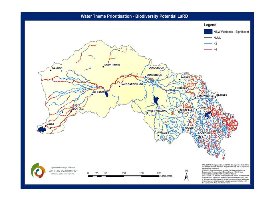 Riparian vegetation throughout the catchment contains vulnerable or endangered plant and animal species and often acts as a corridor between patches of remnant native vegetation. Areas within the Lachlan Catchment identified through the Lachlan Riparian Database (LaRD), a GIS tool used to map and assess riparian condition throughout the catchment, as having high biodiversity potential are illustrated in the map below. Biodiversity potential refers to the existing value or potential value through rehabilitation and increased connectivity to other riparian or floodplain vegetation. The figure below indicates in red, riparian areas with high biodiversity potential in the Lachlan Catchment. Hydrologic connectivity, that is the connection of rivers, floodplains and wetlands is essential to restoring and maintaining riparian vegetation.