Lake Merrimajeel/Murrumbidgil Swamp
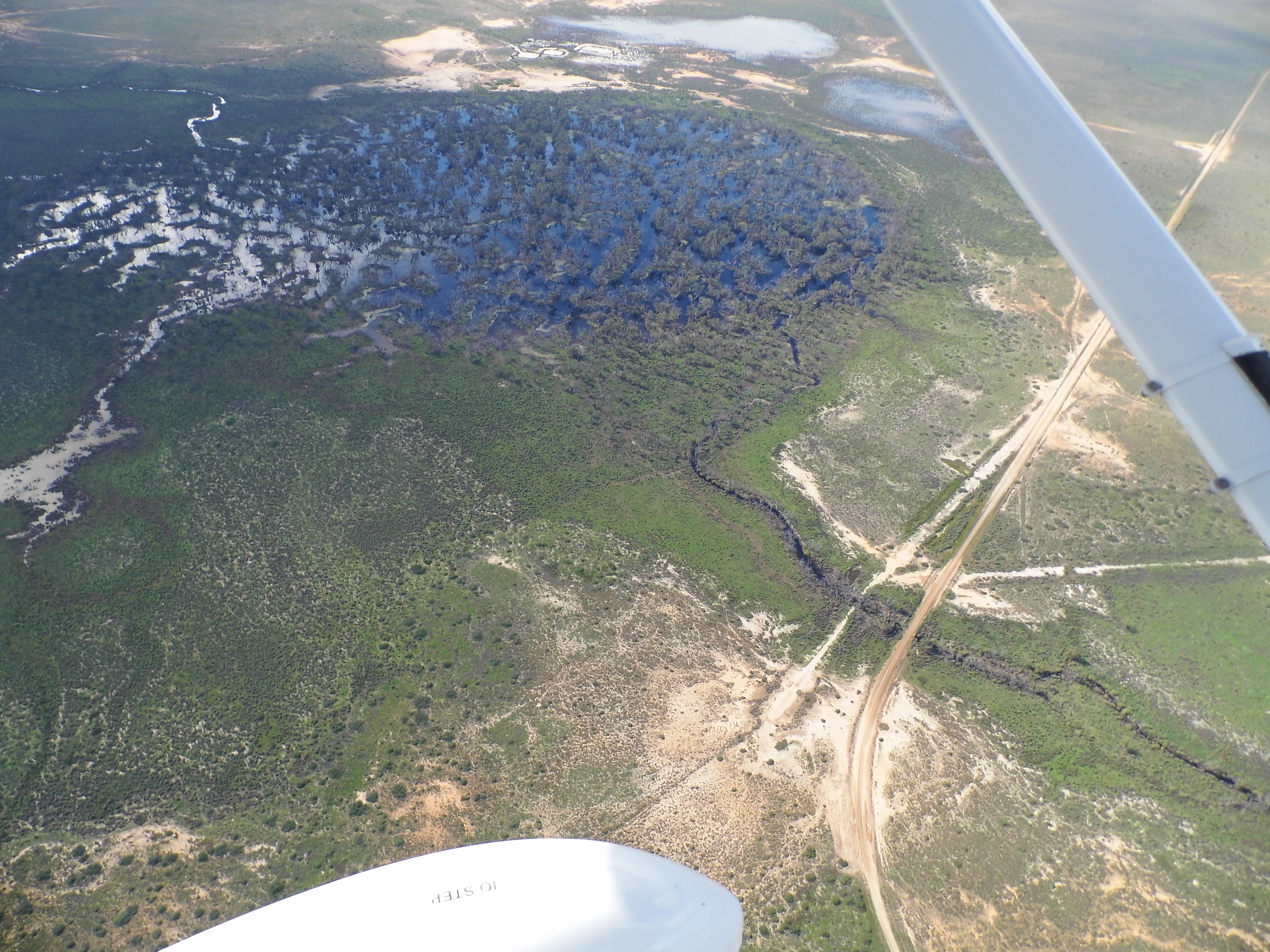
Aerial view of Murrumbidgil Swamp during OEH observational monitoring flight (Image: Paul Packard and List Thurtell, OEH, 24 April 2012)
Merrimajeel Creek is an ephemeral effluent creek receives flows from Torriganny Creek, located near the township of Booligal. Merrimajeel Creek is listed on both the Register of the National Estate, due to Booligal Wetlands providing high value bird breeding areas, and the Directory of Important Wetlands due to the environmental assets associated with Lake Merrimajeel and Murrumbidgil Swamp. Lake Merrimajeel is approximately 110 ha in size and contains areas of open water and is known to be a productive area for wetland-dependent species when inundated. Murrumbidgil Swamp (aka Angora Clump) is the terminal swamp of Merrimajeel Creek, located downstream of Booligal (E281400, N6248600). It is an open swamp which attracts many waterbirds and supported many large River Red Gums. Its current condition is considered critical, with its ecological character threatened due to the length of time since inundation, only receiving about half the water it once did. By using licenced environmental water to help maintain its ecological character, Murrumbidgil Swamp may serve as one measure of a sustainable balance between environmental and extractive use of the Lachlan’s water.
Merrimajeel Creek receives water from the Lachlan River but are not included in the areas of operation of the Water Sharing Plan. However, regulators have been constructed at the mouth of both Muggabah Creek and Merrimajeel Creek to improve water delivery to these creeks and their associated wetlands and to improve the efficiency of delivery of replenishment flows to users on the two creeks.